In the Aran Valley, you can breathe well-being, well-off people, everything is orderly and clean. The roads and tracks in the mountains are in very good condition. It is noted that they enjoy a standard of living higher than the average in Catalonia. It is noted that there are only about 10,000 inhabitants in 620 km2. It is also noted that they are located very far from urban areas and only those who can afford it visit them.
Before 1948, the year in which the Vielha tunnel was completed, they were isolated and had a subsistence economy. When the port of Bonaigua was blocked by snow, they could only leave in the direction of Occitania, following the course of the Garonne River.
The Vall d'Aran faces the Atlantic, which makes its forests noticeably different from those of the rest of Catalonia, which is southern.
Today, the Aran Valley lives mainly from tourism, which represents 80% of its GDP. Its educational system is in Aranese, Catalan, Spanish, French and English. In addition, its baccalaureate is compatible with the Spanish and French educational systems.
The Aran Valley wants to be more than simply the Baqueira Beret ski resort, which almost sold a million ski passes in 136 days during the 2022-2023 season. It seeks to become a tourist destination suitable for all ages and appealing all year round. It certainly has the capabilities to achieve it, it is an exceptional site.
Vielha - the capital
Arties - hot springs
Salardú entrance door to the Colomers mountain cirque
The Colomers cirque, formed by 48 lakes with crystal clear waters, black pine and spruce forests, and impressive mountains that rise nearly 3,000 meters, make this glacial cirque and its valley an essential place during our stay in the Aran Valley.
Saut del Pish in the Varradós Valley
The Saut deth Pish, which is located half an hour from Vielha by paved road, has two waterfalls: the upper one is about 15 m. high and the lower one about 5 m. The water comes from the Long Lake of Liat and comes out through a karst course at the Era Pila source in the Siesso ravine.
Uelhs deth Joeu
The eyes of the devil or Jupiter are spectacular waterfalls fed by the waters of the Aneto glacier. The waters that melt from the glacier disappear in the Forau d'Aigualluts in the Benasque Valley and reappear in the Arán Valley, after a 4 km underground journey. An excursion worth dedicating a whole day to.
The burning of Eth Haro in Les
In Les, they celebrate the solstice during the night of Sant Joan with the burning of eth Haro, a fir tree placed the previous year in the middle of the square. This tradition is part of the Pyrenees fire festivals, recognized as a World Heritage Site by UNESCO in 2015.
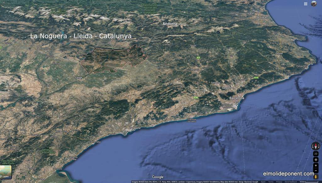
Discover the wonders of La Noguera: activities for families and history
buffs, prehistoric heritage and medieval, exuberant nature, local gastronomy
and exciting adventures outdoor. Explore the Mont-rebei Gorge, caves and
medieval monuments. Enjoy climbing in the Cova Gran de Santa Linya and
sports nautical in the calm waters of the reservoirs from Camarasa,
Canelles, Santa Anna, Sant Llorenç de Montgai and Rialp. A unique
destination in Catalonia for all tastes.
In Balaguer, the capital of Noguera, we can search
for gold in the Segre River with the
Center for Gold Interpretation, which
is part of the Noguera Museum.
In Camarasa, with
Origins Space, we can learn about the
Neanderthals and participate in other activities related to prehistoric,
historical, and natural heritage in the surroundings of the Mont-roig
mountain.
At the
Montsec Astronomical Park
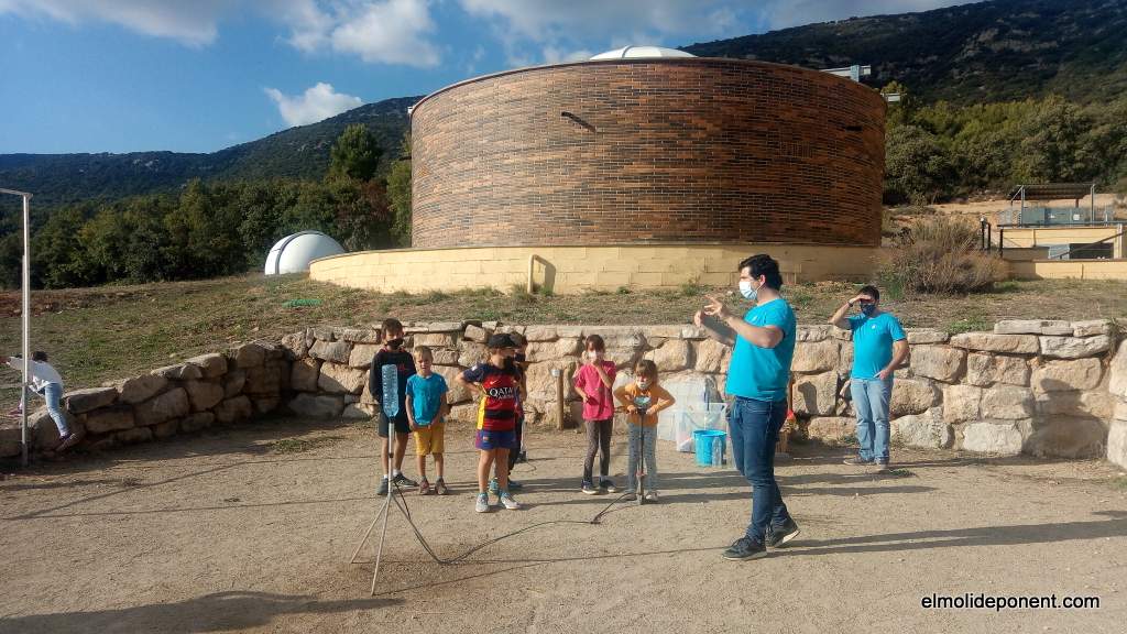
in Àger, in addition to observing space, various
activities related to astronomy and science are organized.
At the
Monastery of Las Avellanas, many interesting activities are organized, such as medieval dinners,
historical events, and nighttime concerts.
Castell del Remei
has established a
Foundation with the aim of
preserving its valuable heritage. Through this initiative, various activities
are organized, including yoga, jazz, exhibitions, wine tastings, concerts, and
races.
Small but Unique Villages
Sant Llorenç de Montgai, a natural reserve for waterbirds, is my favorite place in Noguera. When I
visit, I can feel my heart rate slowing down.
Alòs de Balaguer, more remote,
is the realm of hunters and fishermen.
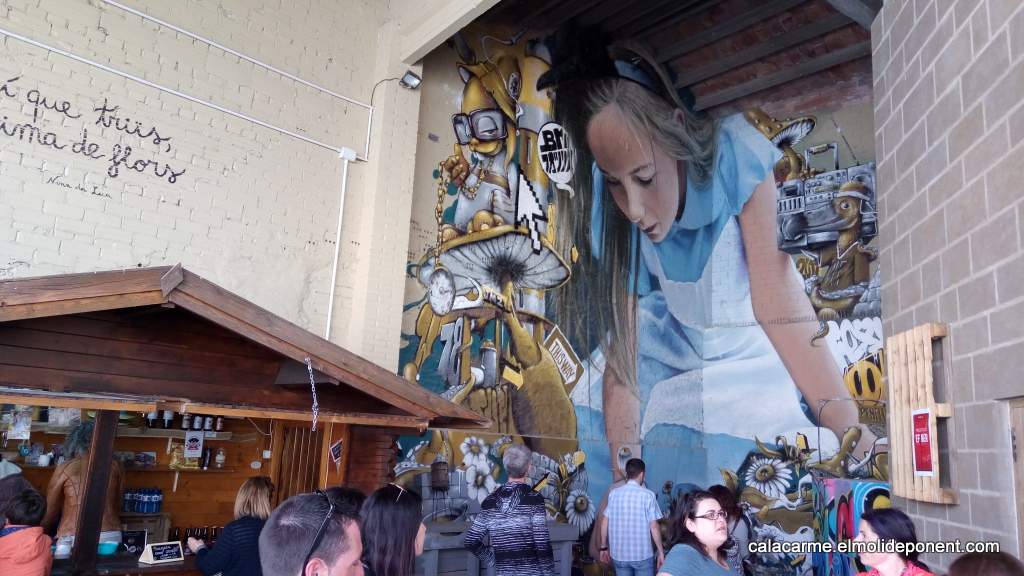
Penelles has become
the capital of Street Art in Lleida.
Tiurana with
its starlight certification is the ideal place to spend summer nights.
Penelles - Street Art
Gastronomy
Barley, wheat, almond trees, olive trees, vineyards, honey, milk, and the
orchard all contribute to the rich
gastronomy of Noguera. Additionally, there are
small workshops that transform these elements into wine, beer, cheeses, jams,
samfaina cakes, and many other culinary delights. These products end up
nourishing our restaurants that are gaining
culinary excellence day by day.
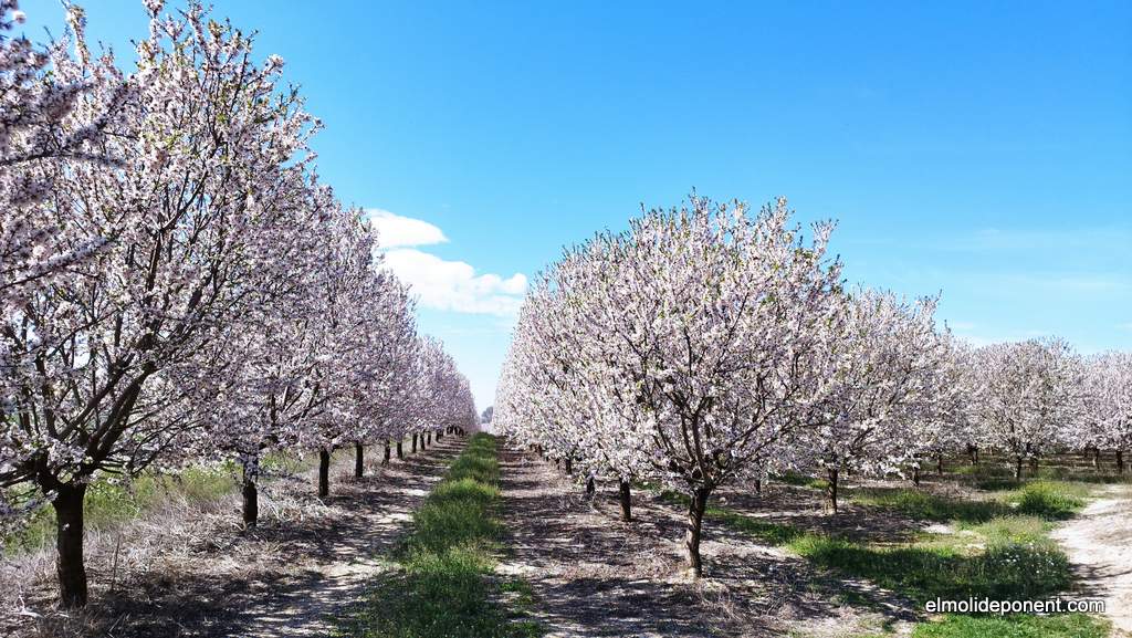
Blossoming almond trees
Heritage
Prehistory chronological axis made by the Museu de la Noguera
From prehistory, we have the rock paintings of the Vilars cave in Os de
Balaguer, the archaeological site of the
Parco cave
in Alòs de Balaguer, the Neanderthal shelters of the
Cova Gran
in Santa Linya, and the Roca dels Bous in Sant Llorenç de Montgai. We also
have fossil sites like
la Pedrera
in Vilanova de Meià.
Map made by the Museu de la Noguera
In the medieval period, Noguera was a borderland and part of the County of
Urgell, where castles, monasteries, and Romanesque hermitages were built, such
as the
Monastery of Santa María de las Avellanas, the
Montsonís Castle,
and the collegiate church of Sant Pere d'Àger.
There are also Spaces of Memory from the Spanish Civil War, such as the
Merengue hill in Camarasa and the wartime remnants around the Cap de Pont in
Balaguer.
We must not forget the extensive heritage of Balaguer, the capital of Noguera,
and its
walls
within which the three monotheistic cultures, Christians, Muslims, and Jews,
coexisted.
The Montsec, Mont-Roig,
Sant Mamet, and the Montclús mountain range offer countless possibilities, such as
hiking to the
Pedrera de Meià
from the Santa Maria de Meià side or from the Doll Road near to Terradets.
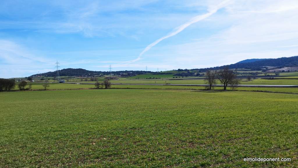
Exploring the plain with its fields that change color with the seasons,
collecting thyme, rosemary, asparagus... Open spaces that are a delight to the
senses.
Barley and wheat fields in February
Motorized Excursions
Our preferred motorized route, whether on a motorcycle or in a car, is the
circuit around Montsec de Rúbies, passing through the Doll Road, Terradets, Barcedana Valley, El Pas Nou, and
Vilanova de Meià Valley.
The
Cova Gran de Santa Linya
is world-renowned in the rock climbing community. Chris Sharma lived in
Sant Llorenç de Montgai
for many years. Accommodations in Camarasa are
always filled with climbers from all over the world.
The Cova Gran de Santa Linya
Active Tourism - Land, Air, Water
In Àger, the capital of
Montsec de Ares, the spirit of adventure sports
permeates the environment. It's an area renowned for free-flying, with a
special emphasis on paragliding and hang gliding. You can also enjoy hot air
ballooning, ultralight flying, as well as gliding and paramotoring. Several
specialized companies and schools offer courses, introductory flights, g uided
outings, and equipment rentals.
The reservoirs of Camarasa, Canelles, Santa Anna,
Sant Llorenç de Montgai, and Rialp,
the largest area of calm waters in Catalonia, are ideal places for water
sports, including kayaking, canoeing, water skiing, and sailing.
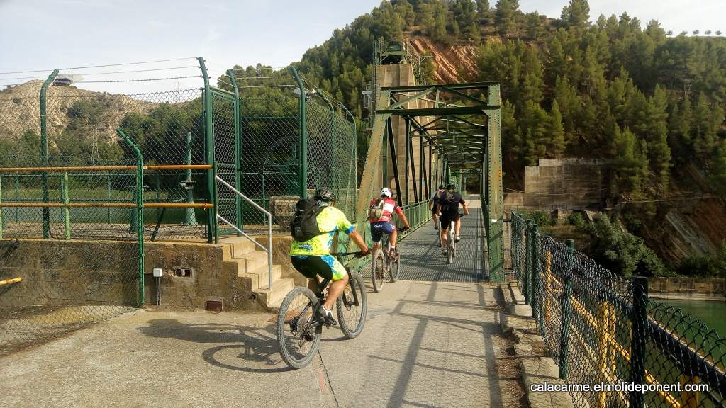
Mountain bikes crossing the Sant Llorenç de Montgai dam
The pastry shop is below the Aran - La Abuela hotel, and you can find the best selection of pastries and specialties from the Aran valley.
It really looks like a place for Lilliputians, it has a very small entrance and you have to go down some stairs below the street, the ceilings are not high and there are no windows, but it is very good and has a good ventilation system.
We went several times while we were in Vielha, for breakfast, for a snack and to play board games.
Eyes of the Devil or Jupiter, a quite beautiful waterfall that gives rise to the Joeu River. The grace is that these waters come from the Aneto glacier which is in a southern valley of the Pyrenees and pass 4 km below the mountains to reappear near the Artiga de Lin.
Plan dera Artiga
La Artiga de Lin is the starting point of great ascents towards the Aneto and Maladeta area, as well as the mythical hills such as Aranesi, Picada and Hòro, places deeply related to the history of the Pyrenees.
Gentiana lutea
Gentian is a medicinal plant that is used as an appetite stimulant. One of the most bitter substances known is extracted from its root.
Aconitum napellus - wolfsbane
The aconite family are very poisonous plants. There are many flowers that give color to the meadows of Artiga de Lin. Artigas are forests that have been cut down to obtain pasture for flocks.
Artiga de Lin Refuge
The refuge is 9 km from the town of Es Bordes along a paved track. Access by private car is restricted in the summer months with greater influx of tourists. The track is also closed in winter due to avalanches.
Guardader dera aigua - Hònt deth Gresilhon
Both the water guard and the Gresilhon sling are very good. And the route to go between fir and beech trees is fantastic.
Small excursions around Uelhs deth Joeu
The arrow marks the second parking lot, which is where we must leave the car, it is a few meters from Uelhs deth Joeu. Then we must go up to Pla dera Artiga and then towards the Refuge where we can have a Coca Cola. From here we can go to the Pish de Pomèro and then return to the starting point. The entire tour lasts a little more than an hour.
We can make a second excursion to the Guardian of the water and the Gresilhon sling, and continue descending to the hermitage of the Mader de Dios de la Artiga de Lin. About an hour, and then you have to go back up.
We wanted to go to one of the shelters in the Aigüestortes i Estany Sant Maurici National Park. Since we were traveling with our young daughters, we opted for the Colomers refuge. It's easily accessible, requiring only a 40-minute walk after reaching the nearest point by car along a paved track that runs from Salardú to Arties, passing through Banhs de Tredòs.
There are 60 sleeping spots, distributed across 5 rooms. Each room has a bunk bed with two levels. That means there are six people side by side on each level, without any separation.
The food is simple and plentiful, and it's quite good. Be careful when ordering lunch as the portions are generous but quite expensive since everything is delivered by helicopter.
Like in all the shelters, there's a great atmosphere, and people come from all over. We shared an excursion with a family from the Netherlands.
From the refuge, you can embark on the circular hike of the Colomers circus and lakes. The short version takes about two hours, while the long one takes approximately six hours. For more details, you can check out these resources: link to Senditur's route and link to Wikiloc's trail.
Lara i Kali
At the Colomers shelter, Lara and Kali were working, who have a show on SX3, the Catalan channel for children. We ran into some kids from Olost who were fans of their show and had gone to see them.
Salardú, a Picture-Perfect Village
From Salardú to Banhs de Tredòs, you can go by your own car, then you need to take a taxi that drops us off about 40 minutes from the shelter on foot.
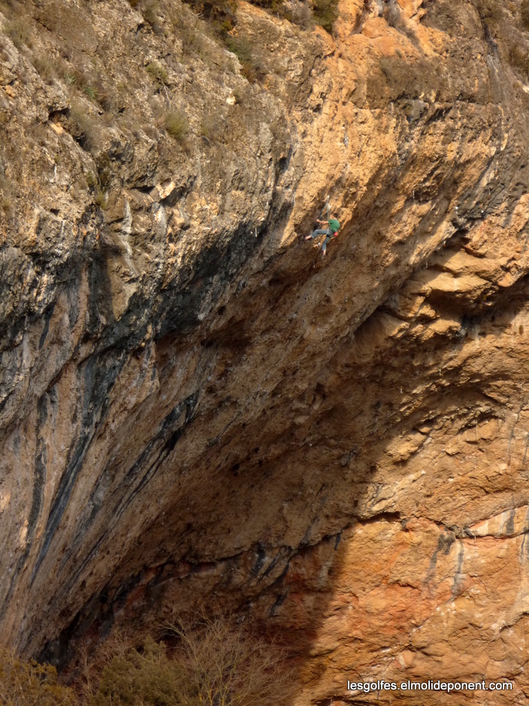
This is an immense shelter of great chromatic beauty, covering 2800 m2 that are disputed by climbers and archaeologists, just as the last Neanderthals and the first Sapiens did thousands of years ago.
According to climbers, it is the best place in the world for sports climbing, as it has a high concentration of challenging routes on high-quality limestone rock. There are 40 routes rated above grade 8, including 7 rated at grade 9. The fact that it often appears in specialized magazines and the frequent presence of media climbers like Chris Sharma attracts people from all over the world, making it a significant tourist attraction for the entire area.
From an archaeological perspective, we have 9 meters of previously unknown strata, discovered in 2002, representing an unprecedented sequence of the last 50,000 years in central Catalonia. So far, according to Rafael Mora, we know that the Neanderthal and the Sapiens coexisted in this cave without biological or cultural mixing.
We hope that this time the actors playing Neanderthals have better luck!
La Linya - the first woman of Noguera
In the 2020 archaeological excavation campaign, remains of a sapiens woman from about 14,000 years ago, from the late Upper Paleolithic period, were discovered. This finding is significant because there are few human remains from this period on the Iberian Peninsula, and it is expected to deepen our understanding of the hunters and gatherers of that time.
The archaeological information sign of Cova Gran
Translated from the Information Panels
The Cova Gran de Santa Linya is located in the middle of a very secluded small valley, formed by the Sant Miquel stream. Despite the apparent isolation of this location within the geography of Noguera, it was inhabited by two hominins: H. neanderthalensis and H. sapiens. This cavity, on the first foothills of the Pre-Pyrenees, preserves evidence of the last 50,000 years of our history.
The Cova Gran allows us to understand the changes in the ways of life of our ancestors, the ancient inhabitants of the Pre-Pyrenees of Noguera, over an extended period. The evidence of these vanished societies is part of the heritage of all citizens. It is the duty of everyone to respect it, protect it, and pass it on to future generations, as it allows us to comprehend how the experience of our human species has evolved over time.
Homo neanderthalensis
The first inhabitants of the cave were groups of Neanderthals, who intermittently settled during their seasonal movements, which defined the hunter-gatherer way of life. Among them, we find rocks made of flint and chert that they used to craft the tools they needed to obtain or transform essential resources, such as food.
Hunting mammals like deer, goats, horses, and bulls, as well as collecting plants and fruits, formed the basis of their subsistence. Fire was a constant in the organization of the social life of these groups.
Cave Engravings
Recent archaeological research has identified five sets of non-figurative engravings on the cave wall: signs, bundles of converging lines, a grouping of shapes, two small grids, and the possible schematic representation of a human figure in the shape of a "Y".
The location of these engravings in relation to archaeological occupations could correlate with the final moments of hunter-gatherer groups that frequented the cave around 10,000 years ago. On the other hand, the bundles of lines and the grids show a wide chronology, ranging from the Mesolithic to the Neolithic, while the "Y" motif is characteristic of the Neolithic.
It is not easy to interpret the meaning of these engravings, but they testify to the presence and influence of prehistoric groups in this cavity over time.
Homo sapiens sapiens
40,000 years ago, a transcendental change occurred: in the cave, we detect the appearance of the first anatomically modern humans. Several phases of these occupations have been recorded, characterized by changes in tools and their craftsmanship, as well as in the way they lived.
They continued to use flint to craft tools, although new instruments made from organic materials such as bone and antler can be detected. Stone tools are now more elongated to facilitate handling, which enabled the emergence of projectiles for long-distance animal hunting.
Fire (3) remained essential, but the shape of the fires changed. They became excavated pits in the ground to better control food cooking and achieve higher temperatures.
Evidence of the use of ornamental elements has also been found, such as marine shells (4) that came from the coast over 150 km away from the cave. This more symbolic aspect is also reflected in engraved bones (5) with geometric motifs and the use of ochre (red pigment), which was likely used both for skin protection and body decoration, possibly as a form of identity expression.
These hunter-gatherer groups were replaced by the first agricultural and pastoral societies around 7,000 years ago. New objects appear, such as ceramic containers and bones from domesticated animals (6), such as goats and sheep, indicating the adoption of a new way of life based on agriculture and animal husbandry.
Throughout this period, the cave was part of a network of settlements related to the transhumance of sheep and goats, connecting the plains of Lleida with the high-altitude meadows of the Pyrenees.